 Open the plan at full size
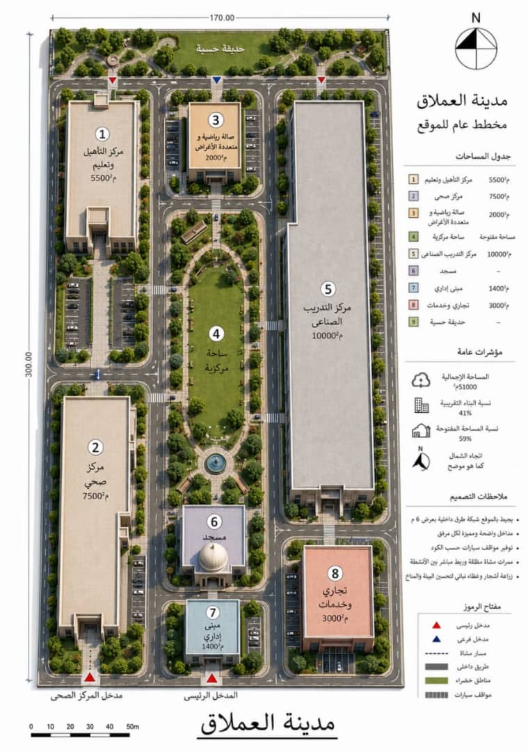
The plan described, for anyone who cannot see it
The plot is rectangular, 170 metres wide by 300 metres deep, totalling 51,000 m². North is at the top of the drawing.
Along the north edge, the sensory garden runs the full width of the site as a landscaped buffer strip. Immediately south of it, in the north-west corner, sits the Rehabilitation and Education Centre at 5,500 m², with a large parking court on its east side. In the north centre is the sports and multi-purpose hall at 2,000 m².
The east strip, running nearly the full depth of the site, is occupied by the Industrial Training Centre at 10,000 m² — the largest single building in the project, a long linear block running north to south, placed deliberately away from the clinical and educational cores.
At the heart of the site lies the central plaza: a landscaped spine with lawn, tree-lined walks and a fountain, linking every activity to the others.
In the south-west corner is the health centre at 7,500 m², with its own separate entrance. In the south centre stands the mosque, domed, on the axis of the central plaza, and south of it the administration building at 1,400 m². The south-east corner holds the commercial and services building at 3,000 m².
Entrances: the main entrance is at the centre of the southern edge. The health centre entrance is separate, to the south-west, keeping clinical traffic apart from general campus traffic. Secondary entrances run along the north edge beside the sensory garden.
Circulation: a 6-metre-wide internal road network serves the site, shaded pedestrian routes link the activities directly, car parking is distributed across the facilities, and there are green areas and tree planting throughout.